
|
GeoRefImg 2.6
Last update:
Fri, 1 March 2013, 12:00:01 pm
Submission date:
Sun, 21 August 2011, 11:00:07 pm
Vote for this product
GeoRefImg description
AutoCAD tool - georeferencing of raster images in plain AutoCAD
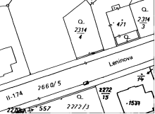
Georeferencing of raster images in plain AutoCAD. GeoRefImg is a LISP utility which automatically repositions raster images used in a drawing to the position defined in the images' World files. World files define geo-position and other parameters of a raster image (TIF, CIT, JPG, PNG, GIF, BMP, ECW, SID...). For AutoCAD 2013, 2012, 2011, 2010. Requirements: AutoCAD 2014,2013,2012,2011,2010,2009 (Architecture,Mechanical,...) Tags: • AutoCAD • image • raster • picture • DWG • CAD • world • georeference • TFW • JPW • GIF • BMP • JPG • photo Comments (0)
FAQs (0)
History
Promote
Author
Analytics
Videos (0)
Share this page


• Audio (646)
• Business & Finance (2483) • Desktop Enhancements (296) • Games (392) • Home & Education (770) • Networks & Internet (1298) • Multimedia & Design (556) • Software Development (314) • Utilities (8230) • Web Authoring (255) • eBooks (5) • Graphics (580) Translate with Google


 Related downloads
• Mini CAD Viewer 3.2.5.1
A compact Free AutoCAD viewer.• ProfiCAD 11 Software for electrical diagrams• ZofzPCB 1.2.0 FREE: 3D Gerber Viewer, Premium: STEP Export• Automapki 1.7.4 Web mapping and satellite imagery for CAD.• Automapki x64 1.7.4 Web mapping and satellite imagery for CAD.• progeCAD 2018 Professional CAD Software 18.0.2.8 Create + edit AutoCAD DWG files at lower cost• Visual Designer 3D 8.0 Visual Designer is a GPU/CPU rendering suite.• 2D/3D cad: dwg, dxf, plt, cgm, svg, pdf 14 2D/3D CAD software: DWG, DXF, STP, IGS, STL• EFM - Etecad File Manager 2.19.1 CAD browser/manager/viewer/workflow acceleran• pdf2cad 12.0 Edit PDF in CAD Programs (DWG, DXF, HPGL)More >>> Top downloads in this category
1. RapidDXF 4.0
Downloads: 1,3432. FlashMNT for AutoCAD and BricsCAD 6.11 Downloads: 1,0023. DXF Works 4.02 Downloads: 7814. FlashPoints for AutoCAD and BricsCAD 3.03 Downloads: 7705. progeCAD 2018 Professional CAD Software 18.0.2.8 Downloads: 3196. ZofzPCB 1.2.0 Downloads: 2557. Mini CAD Viewer 3.2.5.1 Downloads: 2198. pdf2cad 12.0 Downloads: 2179. Automapki x64 1.7.4 Downloads: 21510. TCAD for Delphi.BCB.Kylix.DotNET 2013.7 Downloads: 206More >>> |
Contact Us | Submit Software | Link to Us | Terms Of Service | Privacy Policy |
Editor Login
InfraDrive Tufoxy.com | hunt your software everywhere.
© 2008 - 2024 InfraDrive, Inc. All Rights Reserved
InfraDrive Tufoxy.com | hunt your software everywhere.
© 2008 - 2024 InfraDrive, Inc. All Rights Reserved