
|
Automapki 1.7.4
Last update:
Wed, 1 July 2020, 6:00:02 pm
Submission date:
Thu, 1 September 2011, 6:00:05 pm
Vote for this product
Automapki description
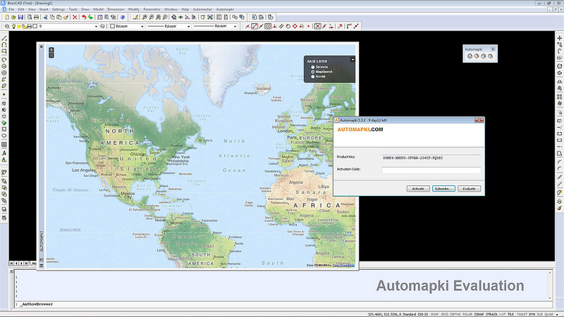
Add web mapping and satellite imagery to AutoCAD / ZWCAD / BricsCAD.
Automapki application brings web mapping and commonly available satellite imagery to AutoCAD / ZWCAD / BricsCAD base DWG editors. It allows to display your project and working area on top of your favourite web mapping source, either Open Street Map, Map Quest, Open Aerial, or any user defined WMS base layer, supports over 3000 coordinate systems, and can merge selected map tiles to create Geo Tiff as a drawing background image. Requirements: AutoCAD 2007 - 2020; ZWCAD+ 2010 - 2018; Bricscad Pro V11 - V19; What's new in this release: Migrate to EPSG:3857 maps projection. Comments (0)
FAQs (0)
History
Promote
Author
Analytics
Videos (0)
Share this page


• Audio (646)
• Business & Finance (2483) • Desktop Enhancements (296) • Games (392) • Home & Education (770) • Networks & Internet (1298) • Multimedia & Design (556) • Software Development (314) • Utilities (8230) • Web Authoring (255) • eBooks (5) • Graphics (580) Translate with Google


 Related downloads
• Mini CAD Viewer 3.2.5.1
A compact Free AutoCAD viewer.• ProfiCAD 11 Software for electrical diagrams• ZofzPCB 1.2.0 FREE: 3D Gerber Viewer, Premium: STEP Export• Automapki x64 1.7.4 Web mapping and satellite imagery for CAD.• progeCAD 2018 Professional CAD Software 18.0.2.8 Create + edit AutoCAD DWG files at lower cost• Visual Designer 3D 8.0 Visual Designer is a GPU/CPU rendering suite.• 2D/3D cad: dwg, dxf, plt, cgm, svg, pdf 14 2D/3D CAD software: DWG, DXF, STP, IGS, STL• EFM - Etecad File Manager 2.19.1 CAD browser/manager/viewer/workflow acceleran• pdf2cad 12.0 Edit PDF in CAD Programs (DWG, DXF, HPGL)• pdf2cad 12.0 Edit PDF in CAD Programs (DWG, DXF, HPGL)More >>> Top downloads in this category
1. DXF Works 4.02
Downloads: 1,6502. RapidDXF 4.0 Downloads: 1,5243. FlashMNT for AutoCAD and BricsCAD 6.11 Downloads: 1,2044. FlashPoints for AutoCAD and BricsCAD 3.03 Downloads: 9415. progeCAD 2018 Professional CAD Software 18.0.2.8 Downloads: 4736. pdf2cad 12.0 Downloads: 4547. 3DBrowser for 3D Users 12.51 Downloads: 4258. Sheet Lightning Pro 6.21 Downloads: 4179. Automapki x64 1.7.4 Downloads: 41110. pdf2cad 12.0 Downloads: 411More >>> |
Contact Us | Submit Software | Link to Us | Terms Of Service | Privacy Policy |
Editor Login
InfraDrive Tufoxy.com | hunt your software everywhere.
© 2008 - 2026 InfraDrive, Inc. All Rights Reserved
InfraDrive Tufoxy.com | hunt your software everywhere.
© 2008 - 2026 InfraDrive, Inc. All Rights Reserved