
|
PrettyMap - World Atlas and Maps, GPS 5.5
Last update:
Mon, 30 May 2011, 1:10:18 am
Submission date:
Mon, 30 May 2011, 1:05:46 am
Vote for this product
PrettyMap - World Atlas and Maps, GPS description
View maps of Earth and other planets! See current day and night regions, ...
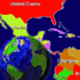
View maps of Earth and other planets with PrettyMap! See current day and night regions, learn geography by taking the quiz, enjoy 3D elevation surfaces, measure distances between locations and create your own maps with special places! PrettyMap lets you view vector and raster maps and images (such as country boundaries, world cities, rivers, satellite photos), search in geographically-referenced data, visualize and analyze spatial information, download current weather reports and forecasts, extend your knowledge by taking an educational quiz, and edit your own simple maps. PrettyMap is a GIS program with the following features: - support for vector maps (points, lines, areas) - support for raster maps (terrain elevation and bathymetry, images, symbolic) - displays maps of various planets - supports GPS, logging GPS locations, wardriving and the "follow GPS" mode - GPS fleet tracking service: PrettyMap can regularly report locations so that you know where your fleet is, and others know where you are - displays current weather maps, detailed weather reports and forecasts (requires Internet connection) - all maps are free: - political: country boundaries with country names, capitals, population sizes, ... - comprehensive set of data for each country, based on the current information from The World Factbook - elevation data for Earth, Moon, Mars - lunar mountains, craters and crater chains, seas, lakes, swamps, valleys, ... - spherical projection - relief and 3D elevation (DEM) view with vector map overlay - shows day and night regions, shadow length and sun/north orientation - zoom range from whole planet to meters - multiple, configurable vector map layers - data search for vector map databases - versatile quiz with teacher mode - bar charts and color-by option - distance measurement - integrated user-defined locations (Points Of Interest) editor, stores notes and values for each POI - sessions to quickly save/restore program state Requirements: PalmOS Tags: • GPS • map • planet • Earth • Moon • Mars • elevation • geography • GIS • day and night • quiz • learn • education • distance • location • POI • satellite • DEM • vector • raster • layer • city • country • river • boundary • longitude • latitude Comments (0)
FAQs (0)
History
Promote
Author
Analytics
Videos (0)
Share this page


• Audio (646)
• Business & Finance (2483) • Desktop Enhancements (296) • Games (392) • Home & Education (770) • Networks & Internet (1298) • Multimedia & Design (556) • Software Development (314) • Utilities (8230) • Web Authoring (255) • eBooks (5) • Graphics (580) Translate with Google


 Related downloads
• Readerware for Windows 4.27
Automatically catalog books, music and videos• Planetary Aspects and Transits 24.04 Displays planetary aspects and transits.• Alfa Ebooks Manager 8 Powerful and easy-to-use book organizer• Aquarium Lab 2019.3 Log aquarium parameters and post to web site• Everything I Own! 4.0.7 The Award Winning Home Inventory Program• myCollections 5.0.2.0 myCollections is the perfect tool to catalog• UK Lottery Generator 4.00 Number generator for lottery / lotto games.• Home or Away League Scheduler 10.0.1 Schedule balanced round robin sports leagues• The GameBook Authoring Tool 1.8 Design a choose your own adventure novel• The StarMessage Diary Software 3.5 Keep an electronic diary of your memoriesMore >>> Top downloads in this category
1. RoboMatic X1 2.0.0.0
Downloads: 9122. Home or Away League Scheduler 10.0.1 Downloads: 5333. Readerware for Windows 4.27 Downloads: 5004. Alfa Ebooks Manager 8 Downloads: 4865. Perfection Florida 1.0 Downloads: 4736. UK Lottery Generator 4.00 Downloads: 4667. Xilisoft PDF to EPUB Converter 1.0.1.0927 Downloads: 4588. Read Music Notes Sing Learn HN 3.00 Downloads: 4429. Aquarium Lab 2019.3 Downloads: 43410. Planetary Aspects and Transits 24.04 Downloads: 433More >>> |
Contact Us | Submit Software | Link to Us | Terms Of Service | Privacy Policy |
Editor Login
InfraDrive Tufoxy.com | hunt your software everywhere.
© 2008 - 2026 InfraDrive, Inc. All Rights Reserved
InfraDrive Tufoxy.com | hunt your software everywhere.
© 2008 - 2026 InfraDrive, Inc. All Rights Reserved