
|
RoboGEO 6.3.2
Last update:
Mon, 27 February 2012, 12:00:01 pm
Submission date:
Tue, 21 December 2010, 6:00:10 am
Vote for this product
RoboGEO description
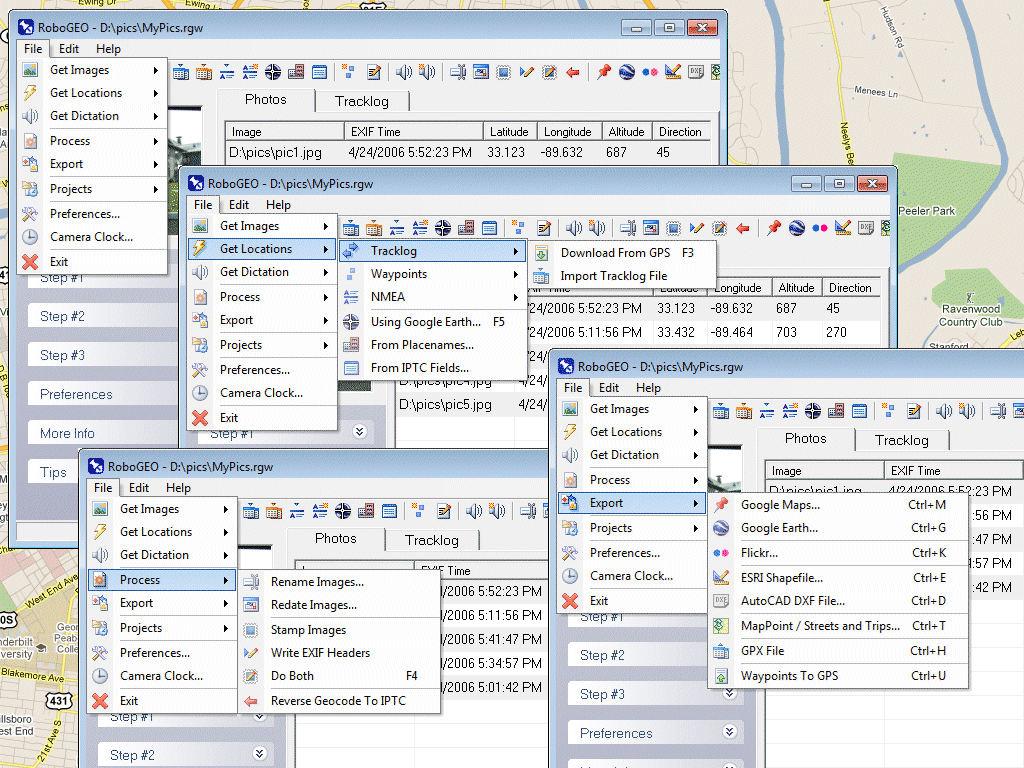
Geocode digital photos and export to Google Earth, SHP, DXF, Flickr, and more.
Geocode digital images with latitude, longitude, altitude, and direction information. RoboGEO stamps this information onto the images or writes it to the EXIF, allowing you to permanently geocode and link your photos to the GPS coordinates. All writing to the EXIF and IPTC headers is lossless and all of the existing comments (including the MakerNote and the Adobe XMP metadata) are preserved. Includes a Picasa-style geotagger for Google Earth. Create web pages that use Google Maps, export KML or KMZ files to Google Earth, upload geotagged photos to Flickr, export ESRI SHP shapefiles, export to MapPoint, or export DXF files to AutoCAD or IntelliCAD. Show the photo direction on maps and calculate it from the GPS tracklog. Merge EXIF or IPTC tags into the image titles and descriptions. Record dictation using any modern digital voice recorder and automatically associate audio with the photos. Rotate or redate images based on the EXIF info. Export GPX files. Edit the EXIF times. Lookup altitudes knowing only lat/lon. Photo locations can be projected to a new location in either ground or airplane mode. Free EXIF/IPTC viewer. Geocode any type of JPG, PNG, BMP, TIF, DNG, NEF, CR2, MRW, ERF, RAF, ORF, PEF, ARW SR2, SRW, RW2, RAW, RWL, and MEF. Directly supports Garmin GPS units (USB or COM), but no GPS is required. Geocode images from a GPS tracklog, KML or KMZ files, NMEA sentences, waypoints, known place names OziExploer PLT files, or TCX files. Import GPX files for interfacing with other GPSs like Magellan and Trimble. Import shapefiles. Rename images per the EXIF data. IPTC editor. UTM and MGRS support. Use any digital camera. Internationally aware. Very easy to use. Nice user interface. Can be fully automated from the command line. Perfect tool for aerial photography, land surveyors, engineers, insurance claim adjusters or anyone who needs to collect field data for integration into a GIS system. Affordable. Free lifetime upgrades. Extensive documentation. Requirements: Windows XP/2000/Vista/Win7 What's new in this release: Added Google Earth polygon file support and the ability to export HTML and enhanced the user-interface Tags: • geocode • georeference • geotag • photo • image • EXIF • GIS • NMEA • GPS • Google Earth • Google Maps • Flickr • MapPoint • Garmin • AutoCAD • DNR • shapefile • SHP • DXF • KML • KMZ • latitude • longitude • tracklog • waypoint • GPX • DNG • JPG • NEF • CR2 • MRW • ORF • ERF • RAW Comments (0)
FAQs (0)
History
Promote
Author
Analytics
Videos (0)
Share this page


• Audio (646)
• Business & Finance (2483) • Desktop Enhancements (296) • Games (392) • Home & Education (770) • Networks & Internet (1298) • Multimedia & Design (556) • Software Development (314) • Utilities (8230) • Web Authoring (255) • eBooks (5) • Graphics (580) Translate with Google


 Related downloads
• Imagelys Picture Styles 10.18.0
Design graphic images easily.• FotoWorks XL 2021 21.0.2 Photo Editing Software for beginners and pro• Diffractor 123.4 The fastest photo and video organizer.• TSR Watermark Image Software - FREE 3.6.1.1 TSR Watermark Image software, protect photos• Image To PDF 1.9.6.1 Convert any picture into a PDF file.• ImBatch 7.3.0 Batch image conversion and processing tool.• Free JPG To PDF Converter 3.0 Free Convert JPG/JPEG images into PDF format.• WireframeSketcher Wireframing Tool 6.3.1 Create wireframes, mockups and prototypes• Free Batch Photo Resizer 2.4.0.2437 Free, simple and handy batch photo resizer• Free Batch Photo Resizer (Portable) 2.4.0.2437 Free, simple and handy batch photo resizerMore >>> Top downloads in this category
1. ReMage - The batch image resizer 2.0.2
Downloads: 1,6932. Webshots File Converter 1.1 Downloads: 1,4043. TSR Watermark Image Software - FREE 3.6.1.1 Downloads: 8754. Photo Collage Maker 5.0 Downloads: 6155. Free Batch Photo Resizer 2.4.0.2437 Downloads: 5916. Diffractor 123.4 Downloads: 5907. WireframeSketcher Wireframing Tool 6.3.1 Downloads: 5778. FotoWorks XL 2021 21.0.2 Downloads: 5709. Batch It Pro 5.21 Downloads: 52710. Imagelys Picture Styles 10.18.0 Downloads: 488More >>> |
Contact Us | Submit Software | Link to Us | Terms Of Service | Privacy Policy |
Editor Login
InfraDrive Tufoxy.com | hunt your software everywhere.
© 2008 - 2026 InfraDrive, Inc. All Rights Reserved
InfraDrive Tufoxy.com | hunt your software everywhere.
© 2008 - 2026 InfraDrive, Inc. All Rights Reserved